This is not one of those blogs.

Instead, Oahu has spectacular aerial views from Terra Firma.
What few people understand about Hawaii is that all of the island residents and tourists are sharing the same few roads and highways. Honolulu and Waikiki traffic can be quite heavy and slow. Want to know why the islands "overreacted" to the recent tsunami? Because (A) they knew that it *could* be bad, but more importantly, they knew (B) that it would take time to get residents to high ground. The moderately populated islands of Kauai, Maui, Hawaii all have essentially one road. Oahu has more, but Honolulu County contains 2/3 of the entire state population with 1/10th the total land area.
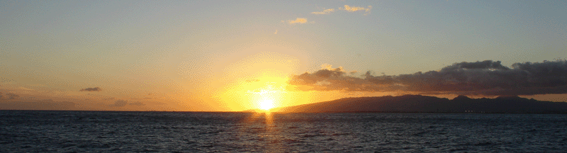
But the highways in Oahu offer some of the most spectacular views in the state (top billing goes to the Hana Highway on Maui). The picture above was the second best view of my day. Unfortunately, the best had to be captured in the mind's eye, as there was no good way to stop and take the picture.
To reach the inland areas of Oahu you climb up from Honolulu along a curving highway that passes among and over steep valleys between abrupt peaks. You're still in the residential regions until you reach the upland plateau between the Ko'olau Range (to your east) and Waianae (to your west). These two ranges are fragments of volcanic craters, and surprisingly, the bulk of what is now Oahu was *between* the craters. The bulk of the original volcanoes slid down the slopes of the undersea mountain that is Oahu, leaving only the two disconnected mountains and a valley between. This land is rich volcanic soil, and grows delicious pineapples, the lure that caused us to brave the traffic on this beautiful day. After a visit to the James Dole Plantation, we returned toward the city, getting a good glimpse of Pearl Harbor as we descended back toward the coastline, then a quick turn onto H3 for our "aerial" tour.
Among the shortest of all Interstate Highways, H3 runs about 15 miles from Pearl Harbor to the Marine Corps Base at Kaneohe Bay. To get there requires crossing the Ko'olau - the only practical way is through. Three highways have tunnels cut through the Ko'olau in this region, and each has a distinctive view. Likelike and Pali Highways pass further south than H3, and most of the view from the road is at somewhat lower altitude. Palie Highway *does* have access to the Pali Lookout, from which the picture was taken.
However, H3, once through the tunnel, provides a view of Kaneohe Bay from above that is truly worth the drive. You look down on the sparkling bay, shades of bright blue reveal the depth of the water and coral formations below the surface. The slopes of the Ko'olau are bright green, the houses appear to be just toys below. You also get a head-on view of the Marine Corps base runway, which further adds to the impression that you are airborne, hovering above ground, perhaps riding the thermals and onshore wind forcing a powerful updraft along the windward side of the island.
It is still part of the winter season in the islands with strong Northeasterly winds, and today was no exception. Winds at the Nu'uanu Pali Lookout, as the above picture was taken, were *steady* at over 50 mph, and gusting much higher. In fact, the area is so well known for it's wind, that in 1931, a sailplane pilot achieved a record 21+ hour continuous glider flight along the same cliffs.
And if I only had wings, I too, could have flown. Instead I settled for a car and the best substitute for an airborne tour in Oahu.
No comments:
Post a Comment
Please add comment - no links, spammers will be banned.